See more categories
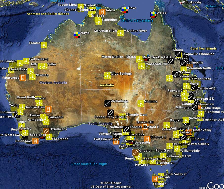
Fossil Fuel Power Stations in Australia interactive Google map
| Year Level(s) | Years 3-6 Years 7-10 Years 11-12 |
| Subject Area(s) | Geography Science SOSE General Science |
| Topic(s) | Coal & Low Emission Technology Energy Environment Mining Rocks & Minerals Non-Renewable Energy |
| Resource Type | Media Image Map |
This is a Google Earth interactive map showing the locations of all operating and proposed fossil fuel power stations in Australia. Each location is represented by name and an icon corresponding to the type of fuel used. Students can click on the icon to see basic information about the ownership and location of the facility.
Queensland Resources Council wishes to acknowledge the considerable assistance provided by Geoscience Australia in the provision of these maps.
NB: To view this map, Google Earth is required. To download Google Earth, go to http://earth.google.com/download-earth.html
Educational value statement
- Uses data supplied by the Australian Department of Sustainability, Environment, Water, Population and Communities
- Students can select which types of power station are displayed
- Students can access street view and 3D building view for some locations
- Can be downloaded as a KML file.
Key learning objectives
- Students investigate the locations of operating and proposed fossil fuel power stations in Australia.
- Students identify the energy sources used to generate electricity in Australia
- Students use geographical information systems to locate and explore places.
Strands
- Science Understanding: Physical sciences
- (Geographical knowledge and understanding: Place)
- (Geographical skills)
Australian Curriculum content statements
Science: ACSSU219